DRONE AND AERIAL SERViCES
- Search and Rescue
- Fireline Mapping
- Aerial Mapping
- Orthomosaic Mapping
- Orthorectified Mapping
- Thermal Scanning
- Thermal Mapping
Search and Rescue
- RAPID RESPONSE: We work with non profit organizations as well as Search and Rescue teams to find lost loved ones
- PART 107 CERTIFIED: Our pilots are part 107 certified and can be added to an organizations Certificate of Authorization (COA). In immediate life or death missions, Fireline IT can request emergent COA approval on behalf of public offices that do not have a pre-approved COA program.
- PUBLIC AIR OPERATIONS: We can help your organization (must be government based) apply for COA approvals for your department.
- COMPASSIONATE SEARCH SOLUTIONS: We are deeply committed to supporting Search and Rescue efforts operations, whether in the hope of reuniting lost loved ones, or when needed, help bring closure by assisting with the search of those missing for a long time. If you are in need of these services please don’t hesitate to
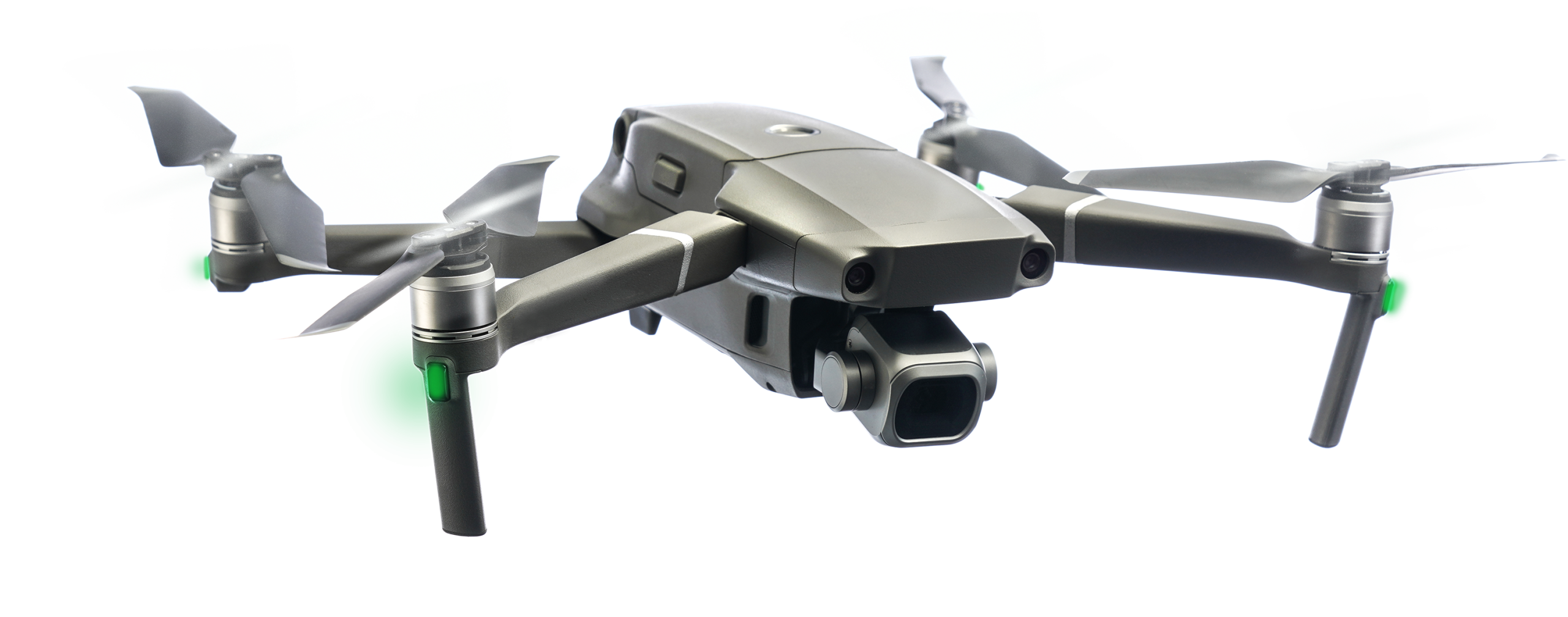
- ADVANCED TECHNOLOGICAL SOLUTIONS: We utilize RGB and thermal scanning to locate items of interest such as articles of clothing, hiking items, water bottles and more. Our Search and Rescue team uses advanced mapping techniques to stitch together thousands of images which allows for the scrutinizing of land based objects or persons to assist in recovery operations.
- MISSION SAFETY: Every flight mission starts with a safety briefing. Almost all missions are operated with a combination of safety coordinators, visual observers and other staff to ensure the safety of the mission. Flight planning, sectional map review and NOTAM considerations are made before each flight to ensure safety to searchers, volunteers and operations.
Our Vision
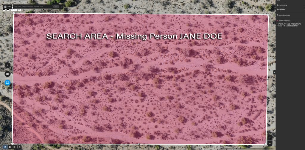
Many missions use orthomosaic mapping for discovery, read below to learn more about this process.
Our Mission
Thermal imaging and RGB imaging are standard tools to recover lost or missing loved ones.
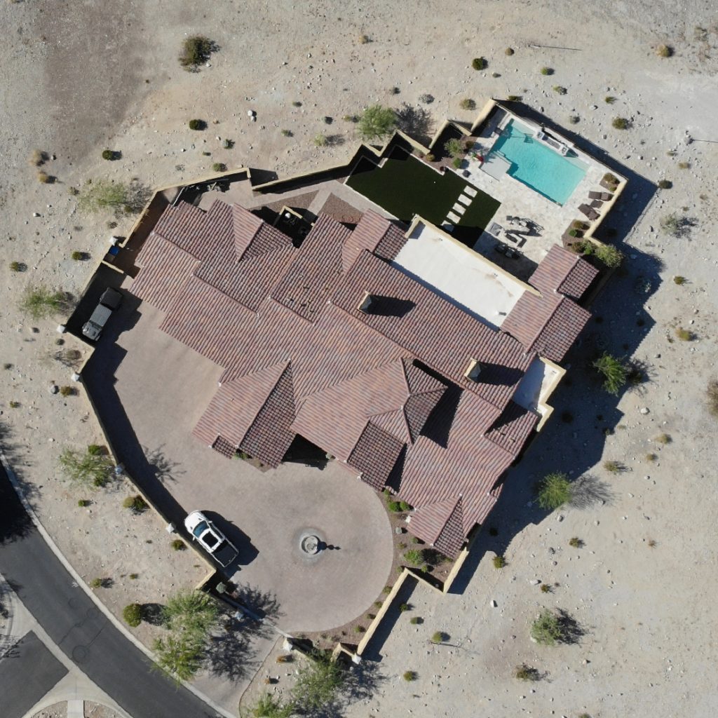
Aerial Mapping
- ADVANCED TECHNOLOGICAL SOLUTIONS: We utilize RGB and thermal scanning to locate key items such as clothing, gear, water bottles, or other clues. Our SAR team employs advanced mapping software to stitch together thousands of images, allowing for high-detail review of terrain and objects to aid recovery efforts.
- ORTHOMOSAIC MAPPING: We create high-resolution composite maps from multiple overlapping drone photos. These maps provide accurate, detailed visuals ideal for search operations, environmental review, and terrain analysis.
- ORTHORECTIFIED MAPPING: Our orthorectified maps are geospatially corrected, ensuring uniform scale and accurate distance measurements. This makes them ideal for mission planning, GIS input, and historical comparison.
- THERMAL SCANNING: Using high-resolution infrared sensors, we can detect heat signatures from people, animals, or objects—helpful in low-visibility conditions, night operations, or wilderness terrain.
- THERMAL MAPPING: We produce full-area thermal maps showing variations in surface temperature. These are used for locating hidden heat sources, detecting recent human activity, and identifying potential hazards.
- FIRELINE MAPPING: Our fireline mapping service provides up-to-date aerial imagery and perimeter mapping during active fire events. This supports fire command, improves situational awareness, and enhances firefighter safety.
- MISSION SAFETY: Every flight begins with a comprehensive safety briefing. Missions are conducted with visual observers, safety coordinators, and experienced pilots. Flight planning includes sectional chart review and NOTAM analysis to ensure operational safety for all involved.
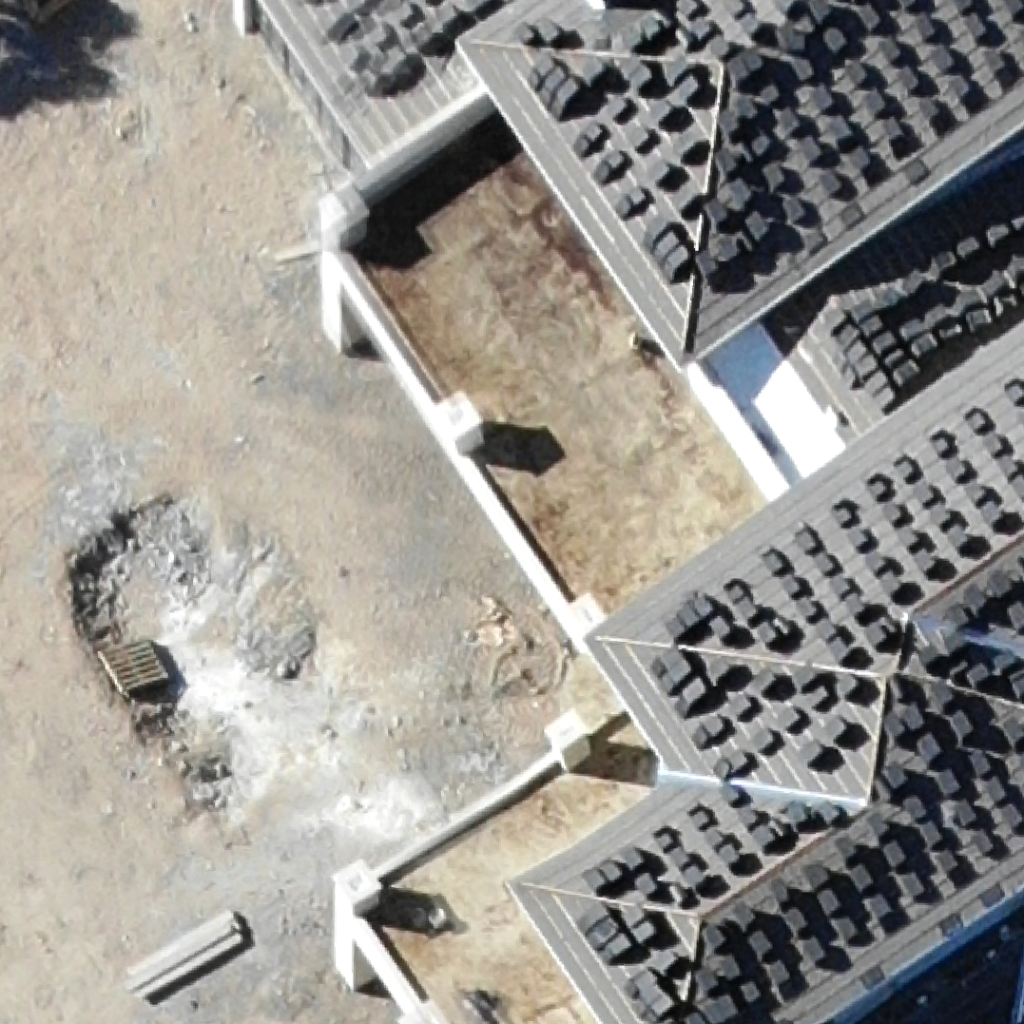
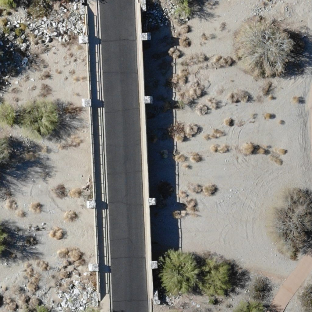
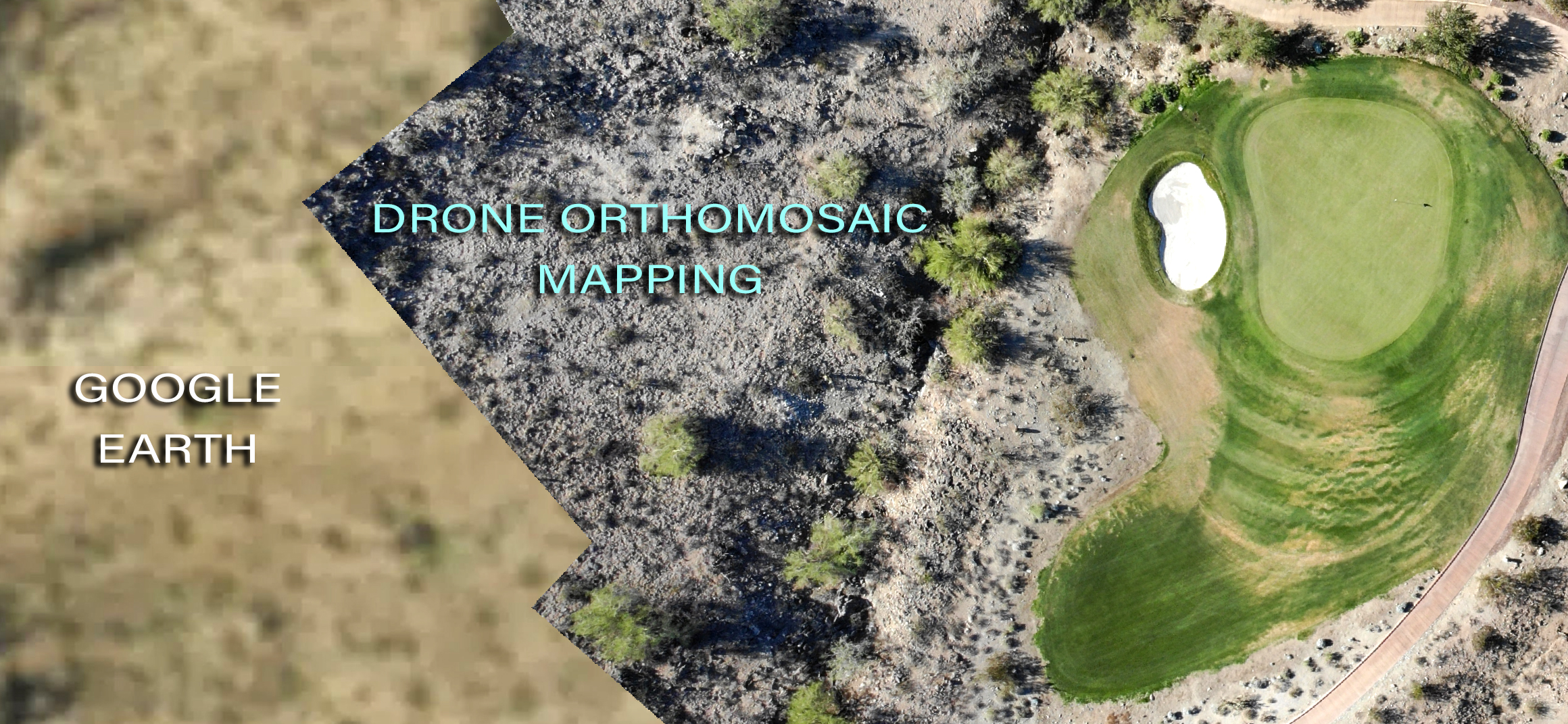
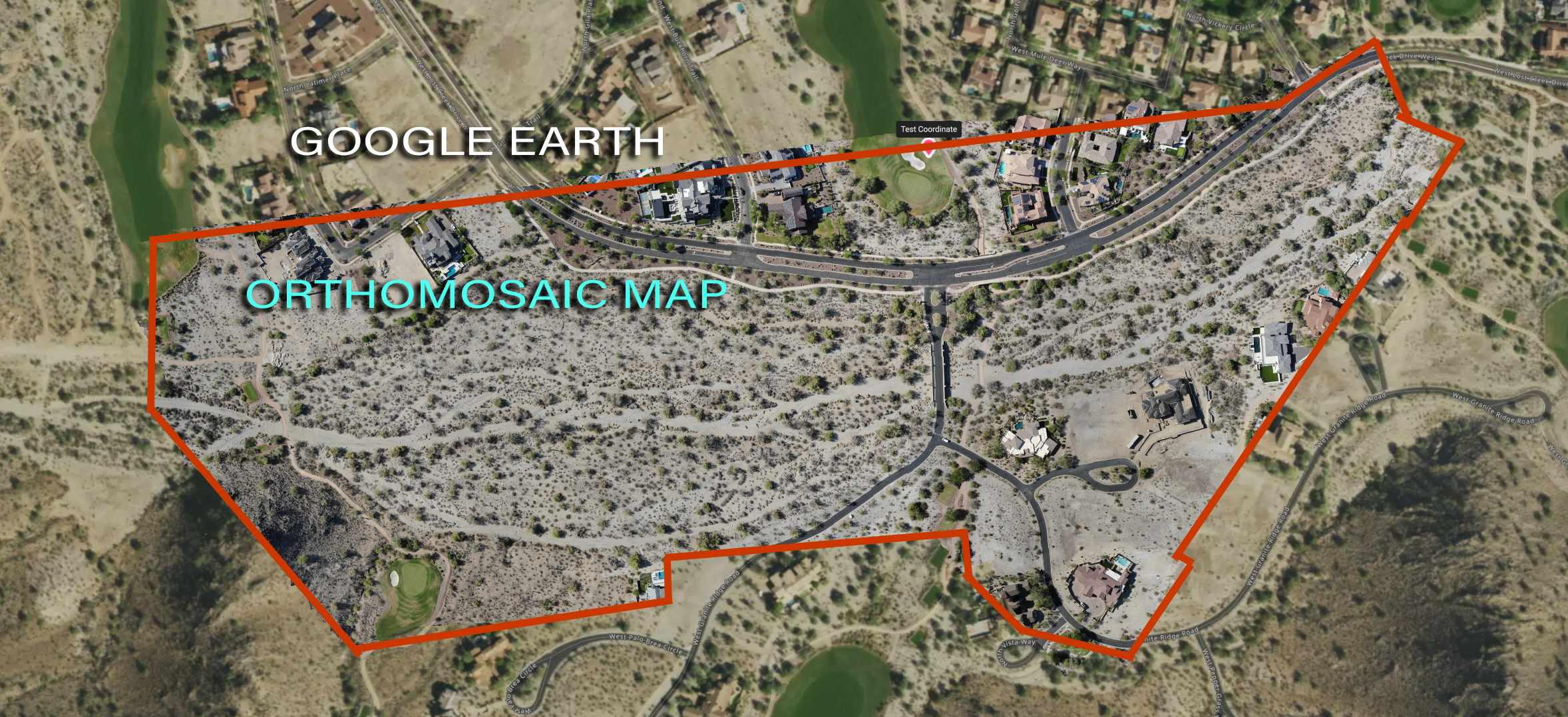
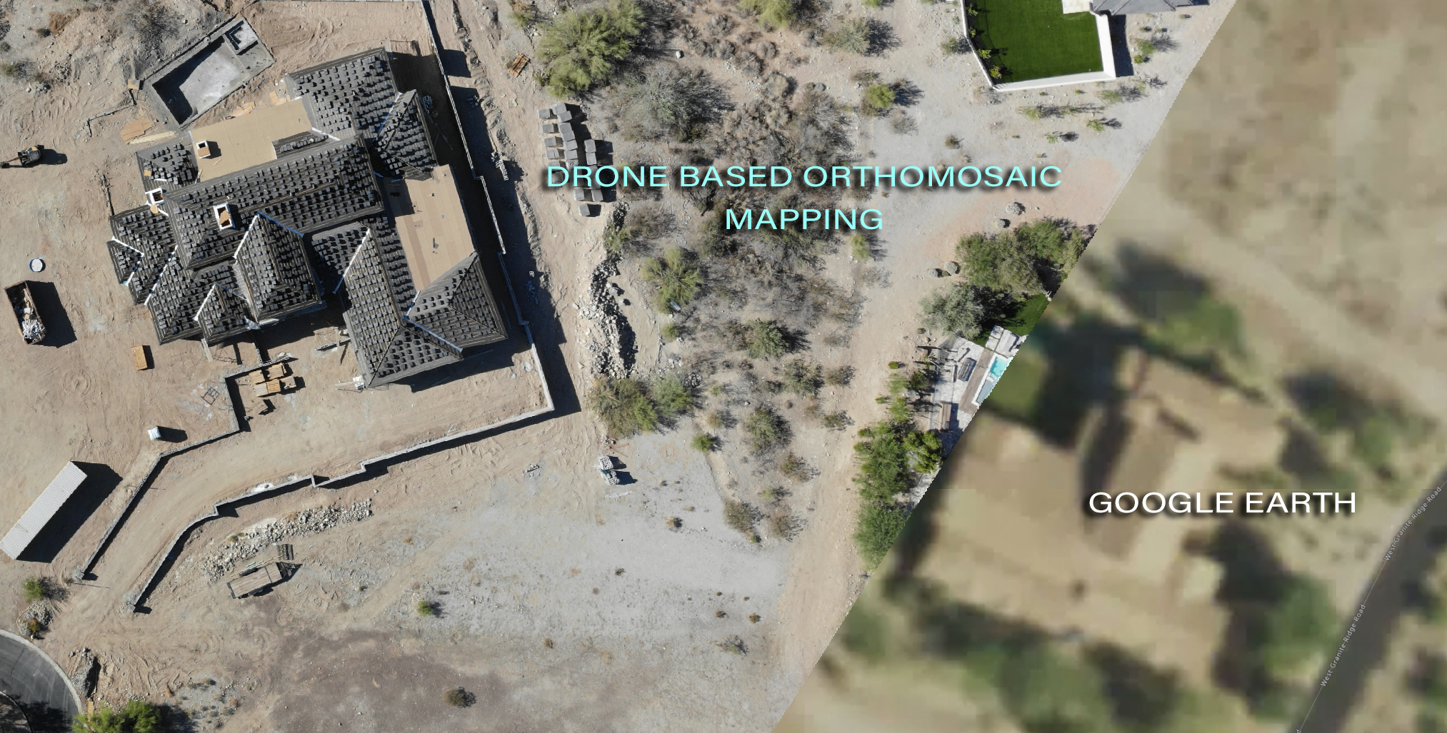
MORE DETAIL THAN SATELLITE MAPPING
Orthomosaic mapping allows for the client to view land and land features in great detail.
AERIAL MAPPING
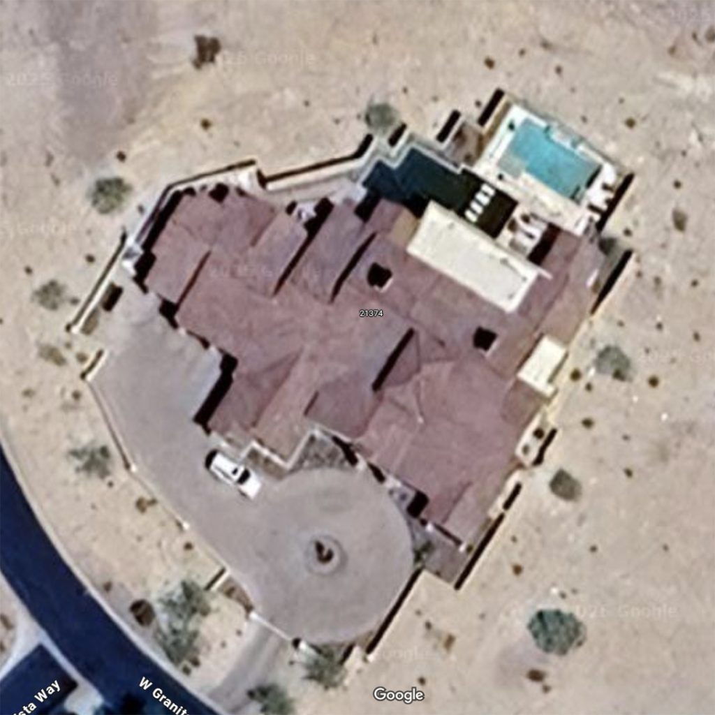
google EARTH
Thermal Mapping
- THERMAL IMAGING: We use advanced infrared sensors to detect and visualize heat signatures from people, animals, equipment, and infrastructure. This allows for effective monitoring in low visibility, at night, or across rugged terrain.
- THERMAL ORTHOMOSAIC MAPPING: By stitching together hundreds (or thousands of thermal images, we generate large-area thermal maps that reveal heat anomalies, human activity, and thermal patterns—critical for search and rescue, fire monitoring, and inspection work.
602-620-2161
tj@firelineit.com
FOR EMERGENCY SUPPORT:
602-628-8872
Whoa—you made it all the way down here! That probably makes you one of the rare few who actually read the whole site. Use the code “TIMMMMMAAAAAAE” when you call, and we’ll hook you up with a free gift—just for being awesome.
Our Services
Copyright © 2025 FIRELINE IT Solutions. All Rights Reserved.